Pages

Showing posts with label Bush Walk. Show all posts

20 March 2023

It's the Little Things

There's an addictive element to this mobile lifestyle. The thought of new places to explore, getting back to basics, waking up to a different view, meeting new people ... there are so many positives. 
For me, at the top of the list, is having time to enjoy the simple things. Such as ...

W
atching sunrises.


Being at the beach, with my dogs.


Bush walks. 


Birdlife.


Finding wild flowers and having time to study their colours and patterns.


Listening and watching waves. 


Knowing my dogs are happy. 


Watching sunsets.


And something I really, really appreciate, is going to bed knowing I don't have work the next day, and there will be no alarm to wake me. 

What do you enjoy about this lifestyle?

23 February 2023

A Bush Walk - A Random Wall and A Very Close Call!

From the photos I've seen, Marble Hill Campsite looked like a nice place to stay. For awhile now, I've wanted to visit but it's a DOC camp and no dogs are allowed. However, recently I was passing by and the dogs weren't with me, so I stopped to check it out.


Marble Hill Campsite is located 5km east of Springs Junction, on Lewis Pass Highway (SH7). It's a large area suitable for any length campervan, with a selection of hard, flat areas to park, and little secluded nooks for the smaller campers and tents.

Near the end of the campsite, on the left, is a shelter and it's here that the popular Lake Daniell track begins, it's about 8kms one way and can be done in a day. The shelter is also where the Sluice Box Walk begins. The sluice box is a deep, narrow gorge along the Maruia River.  

The track winds through a beautiful beech forest. Every now and then I noticed a splash of colour, which stood out amongst the many shades of green and brown. Nature really is breathtaking!

It wasn't long before I came to the Sluice Box Bridge. Usually, it's an easy 5 minute walk to the bridge, however I took a little longer because I kept stopping to take photos.

The colour of the water below was stunning.- another of nature's gems. 


As tempting as it was to continue walking, I had a long drive ahead. The rest of the walk would have to wait for another time.  


As I was nearing where I'd parked the car, I noticed a worn, grass track leading towards a low concrete, wall  - I went to investigate.


I'm pleased I did because I discovered this random concrete wall had been built for a purpose. The wall was built by scientists in 1964 and is 24 metres long and 1.4 metres high, with most of it underground. 


It turned out that the wall hadn't been randomly put there, it had been precisely placed to sit through the middle of the Alpine Fault. Scientists were monitoring movement in the Alpine Fault and their theory was if one side of the fault moved in relation to the other, it would be measured on the wall.


It's reassuring to note, since the wall has been there, it hasn't moved, and because there's been no movement in almost 60 years it indicates that the Alpine Fault doesn't make small movements. Instead like most active faults in New Zealand (and worldwide), it makes large movements!

And close to the wall, is a fenced area that Maruia School children have adopted as a restoration project for two vulnerable frost flat plant species.


Time was marching on, so I wandered back to the car, stopping to admire wildflowers amongst the grass.


Not far away were several campers nestled at the edge of the beech forest. It looked like a great spot!


I was pleased I'd spent a few hours exploring and can see why many people recommend it. 

Leaving the campsite, I stopped at the main road to give way. There were no vehicles on my left and on my right, I noticed a vehicle in the distance. So I pulled out. However, within seconds, I saw that the vehicle on my right was being over taken - the over-taking car must have been in a blind spot. I only had seconds to react, which strangely, at the time, felt longer. There was no option except to drive straight ahead, which fortunately happened to have a pull over area. I was literally seconds away from being hit and what surprises me to this day is how calm I felt in those split seconds.

However, afterwards, I didn't feel so calm. I kept replaying it over and over and questioned myself over an over. By the grace of God, I'd narrowly avoided being in an accident. It's been a wake up call. Check, check and check again!

Life could have changed so quickly.   

20 February 2023

St James Tarn

If you enjoy alpine scenery, alpine walks and alpine vegetation, I recommend stopping at St James Tarn (along Lewis Pass Highway). Only a few metres from the carpark, lies a picturesque tarn and on a still-day you'll be rewarded with reflections

The photo below was taken a few years ago when I stopped for the dogs to have a stretch. Luckily, there wasn't a breath of wind and the small mountain lake was just like a mirror.

However, when I stopped this time, a slight breeze caused a ruffle over the water, however with or without reflections, it was beautiful.

I decided to walk the 20 minute loop track, which starts at the beginning of the St James Walkway. The track is well maintained and the board walks are covered in netting as a necessary safety precaution when they're covered with ice and snow.

The loop track, also known as the Alpine Nature Walk winds through an alpine wetland with views of Gloriana Peak and the Spenser Mountains.


It amazes me how anything can survive in such harsh conditions; bone dry in summer, ice-cold in winter, battered by wind, and if that's not challenging enough they're somehow able to grow in nutrient-depeleted soil. 


There were lots of varieties of plants; different kinds of grass, flowers (which mostly seemed to be small and white), assortments of mosses, flaxes, intriguing-looking lichen, native hebes, etc. I'm not sure of the correct names for the plants but one day I'll download a phone app that  identifies plants.


It was an easy walk and one that took longer than the estimated 20 minutes because I stopped so many times to look and touch different plants. Some of the flax leaves looked woolly and felt soft and furry. There were mounds of lichen that looked like clumps of coral and felt brittle and delicate to touch.  


Even on a calm day, some of the trees had a wind-swept look with lichen hanging from their branches.


Maybe when I stop here again, I'll have more time - it would be nice to walk further along the St James Walkway. Apparently the entire walk is 66kms and usually takes between three to five days, with huts along the way. It's suitable for all ages and abilities, so I may get an opportunity in the future, to see what overnight tramping is like.


Being a scorcher of a day, with no wind, it was a treat getting into the car and blasting the air-conditioning! 

11 October 2021

Known As One of the Most Beautiful Lakes in New Zealand.

Located about half an hour inland from Hokitika is Lake Kaniere, also known as one of the most beautiful lakes in New ZealandSurrounded on three sides by mountains and native forest, this glacial lake is almost 200 metres deep in places! Can you imagine how big the eels would be in a lake that deep? 

Lake Kaniere Reserve offers several walks ranging in length and is popular for camping, mountain biking, bird-watching, swimming, water-skiing, jetboating, and other outdoor activities. 


The first walk I took was the 'Canoe Cove' walk. It's an easy track and easy to find. As you drive along the eastern side of the lake, it's the first walk on the right. The track goes through a rimu and kahikatea forest to a sheltered inlet. 

Near the start of the walk are a couple of boardwalks over shallow, tea-coloured water. There's wire mesh covering the boards to provide grip ... the walkways must get pretty slippery at times.

I find it so uplifting walking in the bush - It's as though a weight gets lifted from my shoulders. There's no traffic noise, no hustle and bustle, just a feeling of peacefulness. The only sound was bird song, the air was filled with an earthy fragrance, towering native trees filtered the sunlight, and all around, plant life was thriving. Bliss.

Nature's artwork

At the end of the track, was a small sandy beach that curves around to an inlet. The lake was full when I visited so there wasn't much room between the water and bush but I managed to skirt around the edges without getting my feet wet.


Across the water, I spotted a rope hanging from one of the branches over the lake. Oh my goodness wouldn't that be so much fun in summer? If you click on the photo below (to enlarge it) you'll see the rope to the left.


Although it's only a short walk, it took me much longer than the suggested 15 minutes each way. I stopped a lot! - to look at fungi, to poke spongy, mounds of moss, to take photos, and to soak in all the beauty around me.

Bracket Fungi

Koru - the beginning of life


Back at the car, my car-key decided to play up! It's one of those remote thingies, where you press a button to open and lock the car. Before I had even pressed any button, the car started to unlock and lock itself over and over again. Luckily there was a 'normal' key inside the remote which I used to get into the car, but even inside the car, the door continued locking and unlocking repeatedly. In the end, I pulled the battery out and all was good.
After that wee predicament, I continued along the road to Hans Bay, which is a small settlement of about 50 houses. Most of the houses are holiday homes with views across the lake. 
Between the road and lake is a grassy area, the perfect place for a picnic and it's here that you'll find the boat ramp and a jetty for those who want to try their luck fishing. 


Also at Hans Bay is a DOC campground that's big enough for larger motorhomes/caravans, plus it has lakeside views. Unfortunately 'No Dogs' are permitted. 

Leaving Hans Bay and continuing eastwards along the lake's edge, the road changes to gravel. It's well maintained, although a little narrow at times. A few kilometres further up the road are the Dorothy Falls.

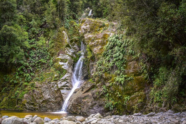
Dorothy Falls can easily be seen from the road - once over a little bridge, there's an area to park. It's a very short one-minute walk to the bottom of the falls, it'd be an ideal spot to cool off on hot summer days.


After taking a few photos, I jumped in the car and drove back the way I'd come. There's a fork in the road at the northern end of the lake. The road to the left travels along the western side of the lake, while the right turn leads to Hokitika. I decided to have a look along the west side of the lake. The road is called Sunny Bight Road and is about a kilometre long - it leads to the Sunny Bight picnic area which has views across the lake.


The next time I visit Lake Kaniere, I'll try to get there early morning, before there's any breeze. I'd love to see the reflections on a calm day. 


A sign from the rest area indicated that a short distance along the road was the beginning of the Lake Kaniere Walkway. It's a four-hour walk around the western shore of the lake, which ends at the southern end of Lake Kaniere on Dorothy Falls Road. I'll do that walk another time.

The road leading to Lake Kaniere Walkway.

Feeling recharged and rested, and with a camera full of photos, I headed back to Bernie and our two 4-legged kids.