The Kawatiri River Trail is a picturesque walking and biking track that runs alongside the Buller/Kawatiri River in Westport.
About eight years ago, the Buller Cycling Club came up with an idea to create a network of trails through an area of wasteland and the Westport community made it happen. What was once mud, gorse and wetland, has now been transformed into an eight kilometre bike and walking trail. And, remarkably, all this was achieved by volunteers.
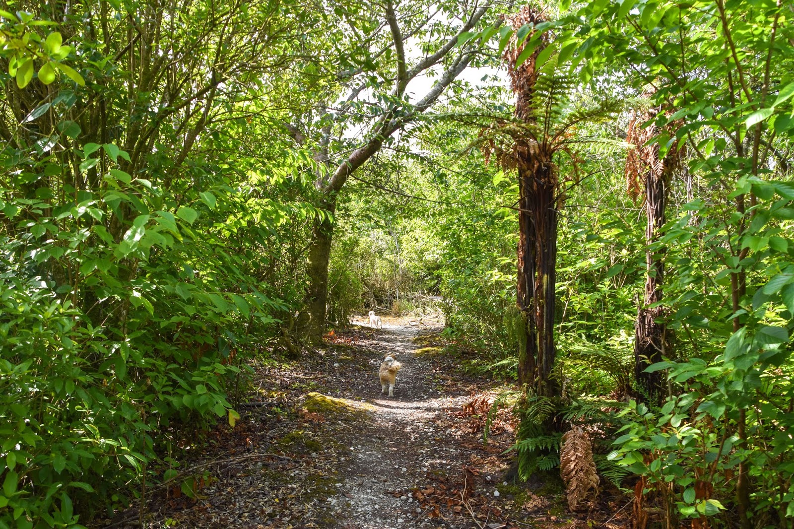
The dog-friendly walk starts (or finishes, depending which end you begin) beside the NZMCA Park, at North Beach. The track winds through native bush, amongst many shades of green flora.
 |
| NZMCA Park, North Beach. |
 |
| Start (or end) of the Kawatiri Track. |
Old hockey turf or weed mat forms the base of the path with a covering of gravel. The track twists and turns, towards Shingles Beach (a small sand beach on the Buller River). It's a place that holds fond childhood memories for Bernie. He spent many of his younger years at Shingles Beach, swimming, surfing and riding waves. When we got to the beach, Bernie bailed on the rest of the walk, deciding instead to sit and reminisce. So, my furry friends and I continued on, unchaperoned.
 |
| Swimmers at Shingles Beach |
 |
| Looking down the Buller River towards the river mouth. |
From Shingles Beach, we headed towards the Lost Lagoon. The track became more open, with a change in vegetation.
 |
| Weka territory! |
 |
| Lost Lagoon |
After two years of planning, followed by three and a half months of building, a bridge materialised over The Lost Lagoon. All credit must go to the enormous effort and support from the community, making what had started out as an idea, turn into a reality. The bridge was aptly named 'The Volunteer's Bridge,' honouring the people who made it happen.
 |
Volunteer's Bridge over The Lost Lagoon
|
Further along, we came to the 'Floating Basin Boardwalk', which is 200 metres long! Again, the construction of this challenging project was achieved by locals. A crew of up to 15 volunteers, spent 10 weeks making the boardwalk, which was financed through fund-raising. Contributions were made from DOC, Holcim, Westport's Mitre 10, the Council and community-funding. Locals lent diggers, chainsaws, compactors and tractors, along with their expertise and many hours of hard work. Everyday, for two months, lunches for the volunteers were supplied by a local cafe. An impressive community effort!

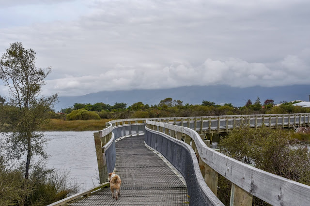
We turned back once we'd crossed the boardwalk, it wasn't the end of the walk but the dogs were hot and in need of some water. After walking over the floating basin (heading away from the port), there's a short walk called the 'Harbour Loop Track', which provides fabulous views of the port and mountains (when they're not hidden in cloud). On a day without wind, the reflections in this sheltered haven are stunning, making it a popular spot for photographers.
In 1988 the Government made a decision to remove itself from operating Westport Harbour. The port and assets (such as the Kawatiri dredge, wharves, jetties etc) were offered to the Westport Borough Council and the Buller District Council, which they accepted.
But alas, in July 2016, the port lost it's biggest customer when Holcim Cement Works closed down and shipping cement from Westport finished.
The remains of an old cattle wharf can be seen alongside the track.
The photo below shows the old cattle wharf and the stocks yards behind.
 |
| Photo supplied with permission |
Part of the old cattle wharf has been revamped into a fishing platform and is the result of another community project. Not only is it a popular fishing spot, it also preserves a special bygone era.
 |
| The new fishing wharf - to the left you can see some of the old cattle wharf. |
 |
| Looking over the old cattle wharf towards the port. |
The track ran beside the Buller River back towards Shingles Beach, where I'd left Bernie. We'd taken longer than I thought so I was surprised he was still waiting. Maybe all the memories of the good old days had made time stand still for him.
 |
| Swimmers at Shingles Beach |
The photo below shows the two breakwaters on each side of the Buller River, which were completed in 1892. These structures were made as barriers to improve access to the port. They were extended by another 300 feet in 1966/7.
The walk back was nice, with wild cherry trees providing some welcome shade.
We wandered through Les Warren Park, passing flowering pohutukawa trees, and then arrived back on North beach.
And, to make my day even better, there was a driftwood teepee. I love seeing these.
During warmer months, North Beach is a sought after spot for swimming and is popular all year round for fishing and surfing. The beach seems to change each time we visit, sometimes it's smothered in piles of driftwood, dumped by thunderous surf. Other times, coloured stones appear and the sea is calm and peaceful.
Oakly still had some energy left, and was excited to be on the beach again!
The perfect place to dig big holes.
DOC manages a freedom camping area, right beside the beach. Both nights we were there, it was full. There aren't too many beaches in New Zealand that still allow camp fires, fortunately North Beach is one of them.
As evening drew to a close, a warm glow of golden light appeared. It was time to get the camera out and take the dogs back to the beach.
 |
| A creative person had made a rustic tree. |
As the sun disappeared behind clouds, Bernie tried his luck with a bit of fishing. However with an outgoing tide, conditions weren't ideal, so there wasn't any fish for dinner that night. But wow, what a beautiful place to hang out.
Westport will always be a special place for me. I look back with fond memories of the brief time I lived there. The people were (and are) friendly and welcoming, and as a community they're truly the best ... quick to rally around to help those in need, or to fundraise for a worthy cause.
Yes, it does have it's fair share of wet weather, but this little West Coast town also has many sunny days (particularly in February). It's rich in history and proud of it - and to top it off, it has some of New Zealand's most stunning scenery.