Pages

Showing posts with label Lewis Pass. Show all posts

23 February 2023

A Bush Walk - A Random Wall and A Very Close Call!

From the photos I've seen, Marble Hill Campsite looked like a nice place to stay. For awhile now, I've wanted to visit but it's a DOC camp and no dogs are allowed. However, recently I was passing by and the dogs weren't with me, so I stopped to check it out.


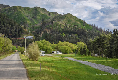
Marble Hill Campsite is located 5km east of Springs Junction, on Lewis Pass Highway (SH7). It's a large area suitable for any length campervan, with a selection of hard, flat areas to park, and little secluded nooks for the smaller campers and tents.

Near the end of the campsite, on the left, is a shelter and it's here that the popular Lake Daniell track begins, it's about 8kms one way and can be done in a day. The shelter is also where the Sluice Box Walk begins. The sluice box is a deep, narrow gorge along the Maruia River.  

The track winds through a beautiful beech forest. Every now and then I noticed a splash of colour, which stood out amongst the many shades of green and brown. Nature really is breathtaking!

It wasn't long before I came to the Sluice Box Bridge. Usually, it's an easy 5 minute walk to the bridge, however I took a little longer because I kept stopping to take photos.

The colour of the water below was stunning.- another of nature's gems. 


As tempting as it was to continue walking, I had a long drive ahead. The rest of the walk would have to wait for another time.  


As I was nearing where I'd parked the car, I noticed a worn, grass track leading towards a low concrete, wall  - I went to investigate.


I'm pleased I did because I discovered this random concrete wall had been built for a purpose. The wall was built by scientists in 1964 and is 24 metres long and 1.4 metres high, with most of it underground. 


It turned out that the wall hadn't been randomly put there, it had been precisely placed to sit through the middle of the Alpine Fault. Scientists were monitoring movement in the Alpine Fault and their theory was if one side of the fault moved in relation to the other, it would be measured on the wall.


It's reassuring to note, since the wall has been there, it hasn't moved, and because there's been no movement in almost 60 years it indicates that the Alpine Fault doesn't make small movements. Instead like most active faults in New Zealand (and worldwide), it makes large movements!

And close to the wall, is a fenced area that Maruia School children have adopted as a restoration project for two vulnerable frost flat plant species.


Time was marching on, so I wandered back to the car, stopping to admire wildflowers amongst the grass.


Not far away were several campers nestled at the edge of the beech forest. It looked like a great spot!


I was pleased I'd spent a few hours exploring and can see why many people recommend it. 

Leaving the campsite, I stopped at the main road to give way. There were no vehicles on my left and on my right, I noticed a vehicle in the distance. So I pulled out. However, within seconds, I saw that the vehicle on my right was being over taken - the over-taking car must have been in a blind spot. I only had seconds to react, which strangely, at the time, felt longer. There was no option except to drive straight ahead, which fortunately happened to have a pull over area. I was literally seconds away from being hit and what surprises me to this day is how calm I felt in those split seconds.

However, afterwards, I didn't feel so calm. I kept replaying it over and over and questioned myself over an over. By the grace of God, I'd narrowly avoided being in an accident. It's been a wake up call. Check, check and check again!

Life could have changed so quickly.   

20 February 2023

St James Tarn

If you enjoy alpine scenery, alpine walks and alpine vegetation, I recommend stopping at St James Tarn (along Lewis Pass Highway). Only a few metres from the carpark, lies a picturesque tarn and on a still-day you'll be rewarded with reflections

The photo below was taken a few years ago when I stopped for the dogs to have a stretch. Luckily, there wasn't a breath of wind and the small mountain lake was just like a mirror.

However, when I stopped this time, a slight breeze caused a ruffle over the water, however with or without reflections, it was beautiful.

I decided to walk the 20 minute loop track, which starts at the beginning of the St James Walkway. The track is well maintained and the board walks are covered in netting as a necessary safety precaution when they're covered with ice and snow.

The loop track, also known as the Alpine Nature Walk winds through an alpine wetland with views of Gloriana Peak and the Spenser Mountains.


It amazes me how anything can survive in such harsh conditions; bone dry in summer, ice-cold in winter, battered by wind, and if that's not challenging enough they're somehow able to grow in nutrient-depeleted soil. 


There were lots of varieties of plants; different kinds of grass, flowers (which mostly seemed to be small and white), assortments of mosses, flaxes, intriguing-looking lichen, native hebes, etc. I'm not sure of the correct names for the plants but one day I'll download a phone app that  identifies plants.


It was an easy walk and one that took longer than the estimated 20 minutes because I stopped so many times to look and touch different plants. Some of the flax leaves looked woolly and felt soft and furry. There were mounds of lichen that looked like clumps of coral and felt brittle and delicate to touch.  


Even on a calm day, some of the trees had a wind-swept look with lichen hanging from their branches.


Maybe when I stop here again, I'll have more time - it would be nice to walk further along the St James Walkway. Apparently the entire walk is 66kms and usually takes between three to five days, with huts along the way. It's suitable for all ages and abilities, so I may get an opportunity in the future, to see what overnight tramping is like.


Being a scorcher of a day, with no wind, it was a treat getting into the car and blasting the air-conditioning! 

17 February 2018

St James Tarn - Lewis Pass

A day without any wind is ideal to capture St James tarn's mirror like reflections.
You might be wondering...what is a tarn? 
Without getting too technical, Google says 'A tarn is a mountain lake or pool, especially one in a cirque. A cirque is a half open steep sided hollow at the head of a valley or on a mountainside, formed by glacial erosion. Tarns are usually smaller than lakes.


The St James Tarn is only a minute's walk from the carpark along Lewis Pass. On a day without wind the reflections really are breath-taking.


A viewing deck provides an outlook across the entire tarn with a mountain backdrop.


On the carpark side of the tarn a track leads across a boardwalk which after a short walk loops back on itself.


Long lichen smothering and dripping from trees created an enchanting area at the end of the tarn.


10 October 2017

Through Lewis Pass to Hanmer Springs

Being newbies to this way of living, we'd mapped out our journey for the first month. However we realised after a rainy day in the rig that sunny weather was easier for us and the dogs. Unfortunately the path we'd so carefully planned had a weather forecast of rain- so we decided to take another route.

It looked like Canterbury was the driest place to be. So we postponed our visit to Reefton and headed to Hanmer Springs instead.

It must of taken about an hour to pack up. I took care of the inside, while Bernie looked after the outside. Then we both did a final check, checking everything was closed and put away securely. That done, Bernie went to the dump station and when he told me there was nothing I could help with (yay), I went on ahead.


I stopped south of Springs Junction to give the dogs a walk. It was threatening to rain but luckily it held off.


Further down the road was the St James walkway. From the carpark there's a 20 minute loop track through an alpine wetland with views of Gloriana Peak and the Spencer Mountains. 


And only a minute's walk from the car is a tarn. Unfortunately there was a slight breeze so I wasn't able to photograph perfect reflections in the water. But it was such a stunning spot.


I just loved the scenery - the orange and red moss. The pale creamy lichen dripping from trees.


As you can see I couldn't stop clicking away from all angles. It was just beautiful.


I just happened to be walking back to the car at the same time Bernie drove past. It was a mad dash to try and get the camera focussed to capture him.


And one last stop as we got nearer to Hanmer. 


The dogs weren't too keen on running through the matagouri - I don't blame them, those spines are vicious.


As we got closer to the Hanmer turn off, the sun appeared. The dogs enjoyed the view as we drove across The Waiau Ferry Bridge.


From the colour of the Waiau River there'd been some recent rain.


The NZMCA park is the first turn on the right after The Hanmer Bridge. It's a lovely spot, with lots of room and the park is fringed with lush, green, willow trees. 


When I arrived Bernie had found a spot to park but as we started to level the rig, the legs had to extend past their length, so we found another spot.


To the right of the rig are clusters of blue grape hyacinths and some orange California Spring Wildflowers.


Another great NZMCA park for only $3 a night/person, max of 3 nights.